You signed in with another tab or window. Reload to refresh your session.You signed out in another tab or window. Reload to refresh your session.You switched accounts on another tab or window. Reload to refresh your session.Dismiss alert
This file contains hidden or bidirectional Unicode text that may be interpreted or compiled differently than what appears below. To review, open the file in an editor that reveals hidden Unicode characters.
Learn more about bidirectional Unicode characters
This file contains hidden or bidirectional Unicode text that may be interpreted or compiled differently than what appears below. To review, open the file in an editor that reveals hidden Unicode characters.
Learn more about bidirectional Unicode characters
This file contains hidden or bidirectional Unicode text that may be interpreted or compiled differently than what appears below. To review, open the file in an editor that reveals hidden Unicode characters.
Learn more about bidirectional Unicode characters
This file contains hidden or bidirectional Unicode text that may be interpreted or compiled differently than what appears below. To review, open the file in an editor that reveals hidden Unicode characters.
Learn more about bidirectional Unicode characters
https://www.openstreetmap.org/way/343176885 Small waterway channels like these are easy to mistake for roads since they can look alike. One giveaway is the presence of any bridges where where it crosses a road.
https://www.openstreetmap.org/way/343145602 This road is the only access for the houses along it. This is not a clear service road by function but a residential road that looks like it has not been constructed fully. My suggestions would be to tag such roads highway=path until it is widened to its full width.
This file contains hidden or bidirectional Unicode text that may be interpreted or compiled differently than what appears below. To review, open the file in an editor that reveals hidden Unicode characters.
Learn more about bidirectional Unicode characters
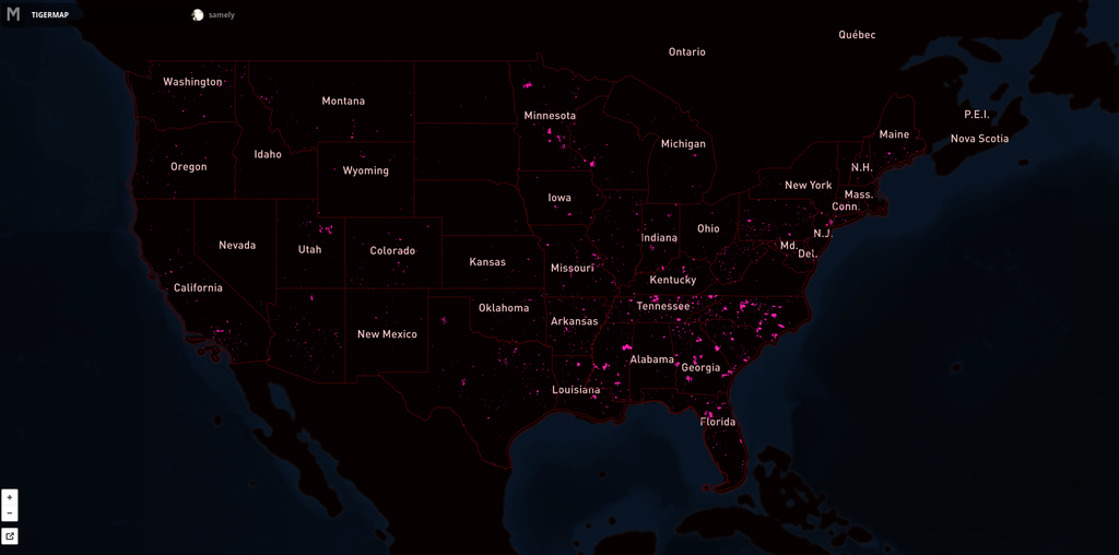
Since September 2012 our team has aligned 260,309 roads in the United States. For this process we use fresh US government TIGER data to show where OpenStreetMap data is out of date, then we trace from imagery as needed and use road names from TIGER. (For a background on TIGER data in OpenStreetMap read Eric Fischer's blog post).
Here's the map showing the extent of the issue. Pink lines are the progress over US. Full interactive map.
We continue our work on TIGER with @MateoV's recent analysis that further focuses our TIGER work. This analysis looks only at areas with high Twitter
Since September 2012 our team has aligned 260,309 roads in the United States. For this process we use fresh US government TIGER data (for a background read Eric Fischer's blog post) to show where OpenStreetMap data is out of date, then we trace from imagery as needed and use road names from TIGER.
Here's the map showing the extent of the issue. Pink lines are the progress over US. Full interactive map.
We continue our work on TIGER with @MateoV's recent analysis that focuses on TIGER issues in areas with high Twitter traffic, missing roads, naming issues and road lengths ov
Since SEPTEMBER 2012 our team has aligned 260 309 roads in the United States. For this process we use fresh US government TIGER data (for a background read Eric Fischer's blog post) to show where OpenStreetMap data is out of date, then we trace from imagery as needed and use road names from TIGER.
Here's the map showing the extent of the issue. Pink lines are the progress over US. Full interactive map.
Since MONTH YEAR our team has aligned XX,000 roads in the United States. For this process we use fresh US government TIGER data (for a background read Eric Fischer's blog post) to show where OpenStreetMap data is out of date, then we trace from imagery as needed and use road names from TIGER.
Here's the map showing the extent of the issue. Pink lines are the progress over US. Full interactive map.